
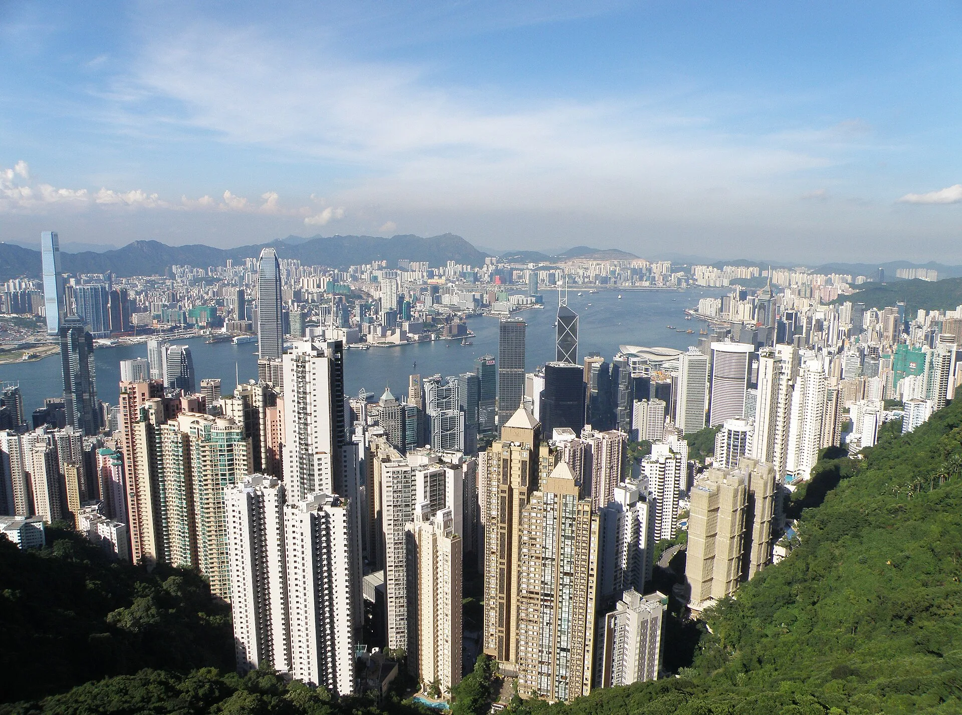
HARBOUR + TERRAIN
Density sits between water and steep green ground.
The daytime overview keeps both sides of Victoria Harbour, the working water and the mountains visible. It is an urban form, not a wall of towers floating without geography.
CITY FIELD GUIDE · South China coast
Dense transit is only the frame; street performance, design, food and mixed languages keep filling it with new life.
Hong Kong belongs in this field guide on its own terms. Its street culture, creative scenes and compact public life sit inside legal, currency and transport systems that must stay explicit.
MULTIPLE SCALES · ONE CITY
A compressed street is not just an image of tall buildings. It is a chain of choices between rail, tram, bus, walking, food and public culture, all operating inside Hong Kong-specific systems.
HARBOUR + TERRAIN
The daytime overview keeps both sides of Victoria Harbour, the working water and the mountains visible. It is an urban form, not a wall of towers floating without geography.
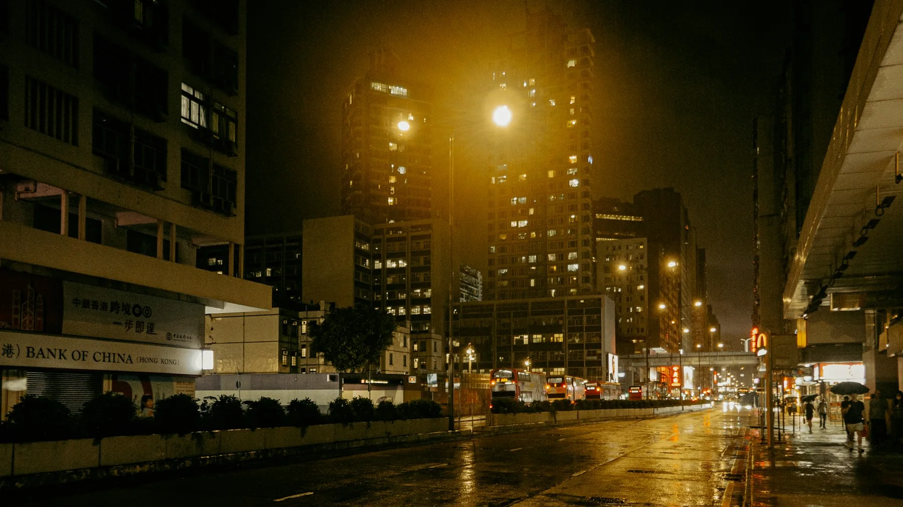
NIGHT TRANSIT
On a wet night, buses, pedestrians, shops and housing occupy the same compressed street section. Hong Kong's famous density is useful only when translated into how an ordinary trip, crossing or late meal actually works.
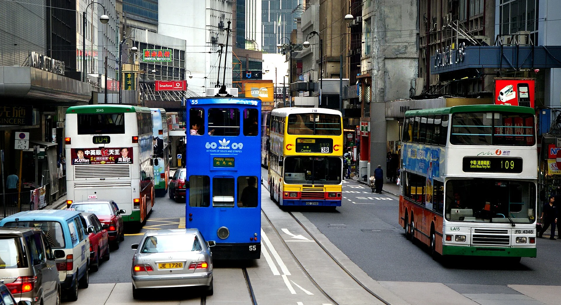
MIXED NETWORK
Trams, buses, ferries, escalators, footbridges and walking routes solve different parts of a steep, compact city. The transfer between them is often more revealing than any one system's headline number.
Read the full route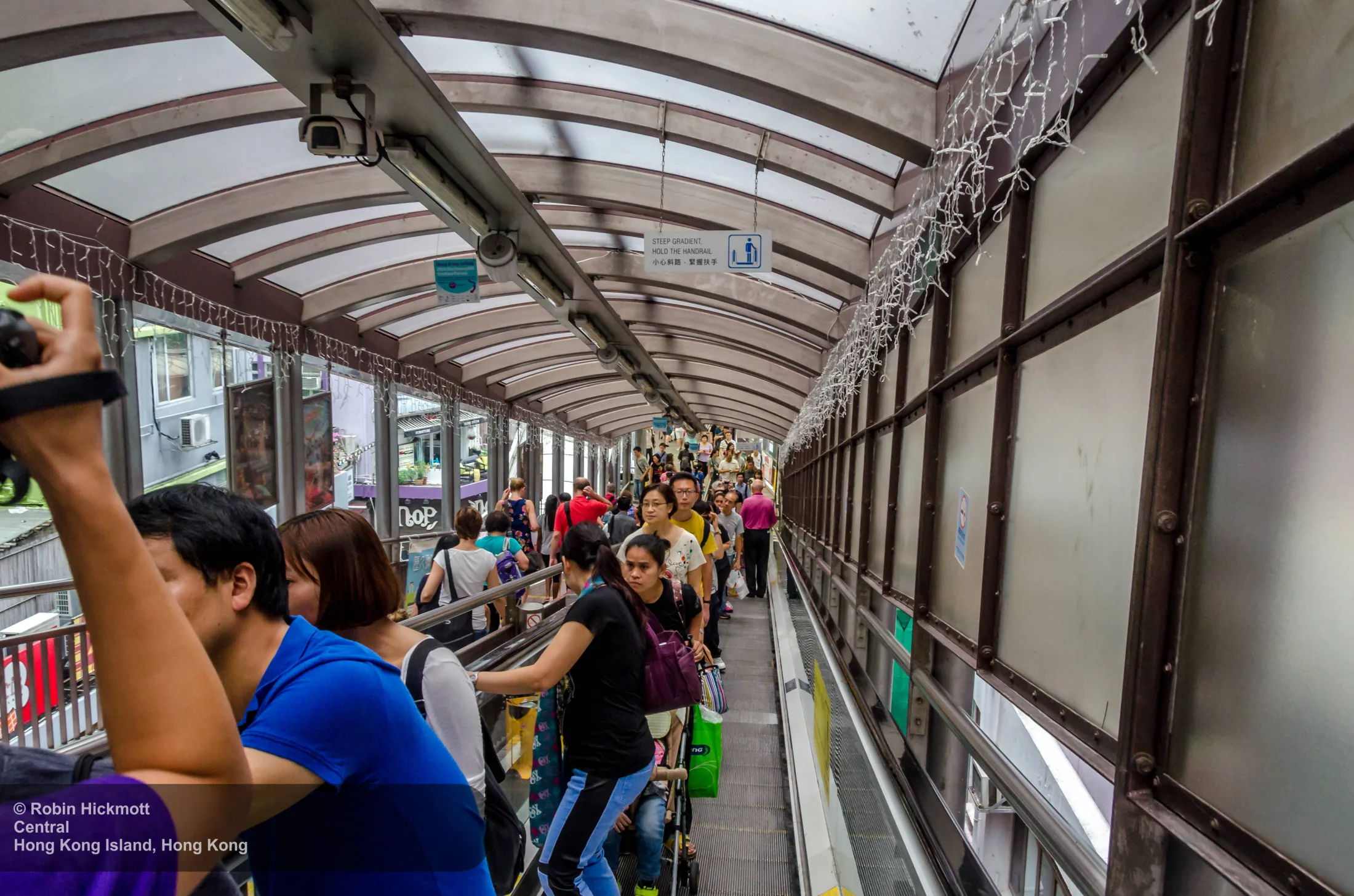
VERTICAL WALKING
The Mid-Levels Escalator joins steep streets, footpaths, shops and building entrances. Its value is not novelty; it changes which routes feel walkable and how upper and lower blocks meet.
Read the full route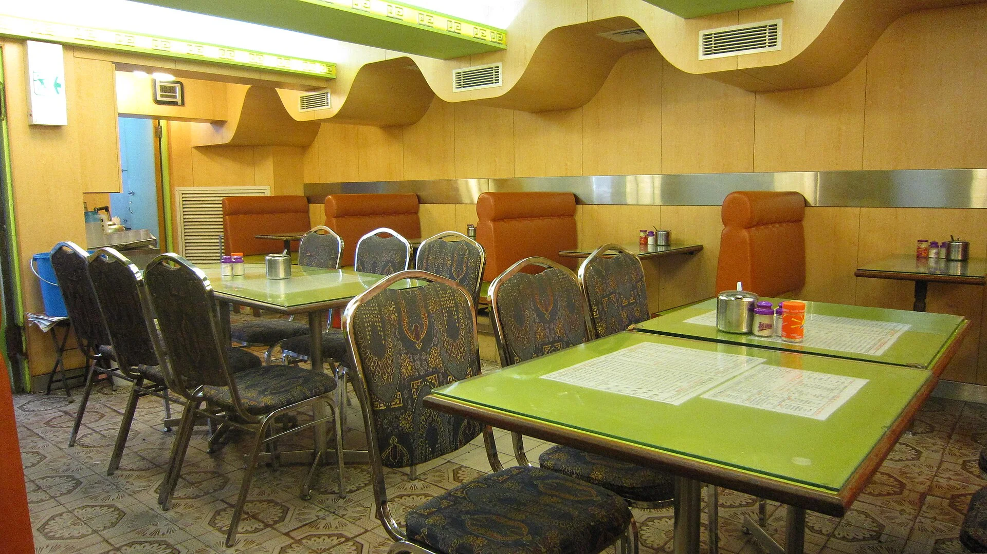
EVERYDAY CULTURE
The cha chaan teng compresses adaptation into service rhythm, language and hybrid dishes. Read the room and menu together instead of treating it as a retro aesthetic detached from working city life.
Read the full route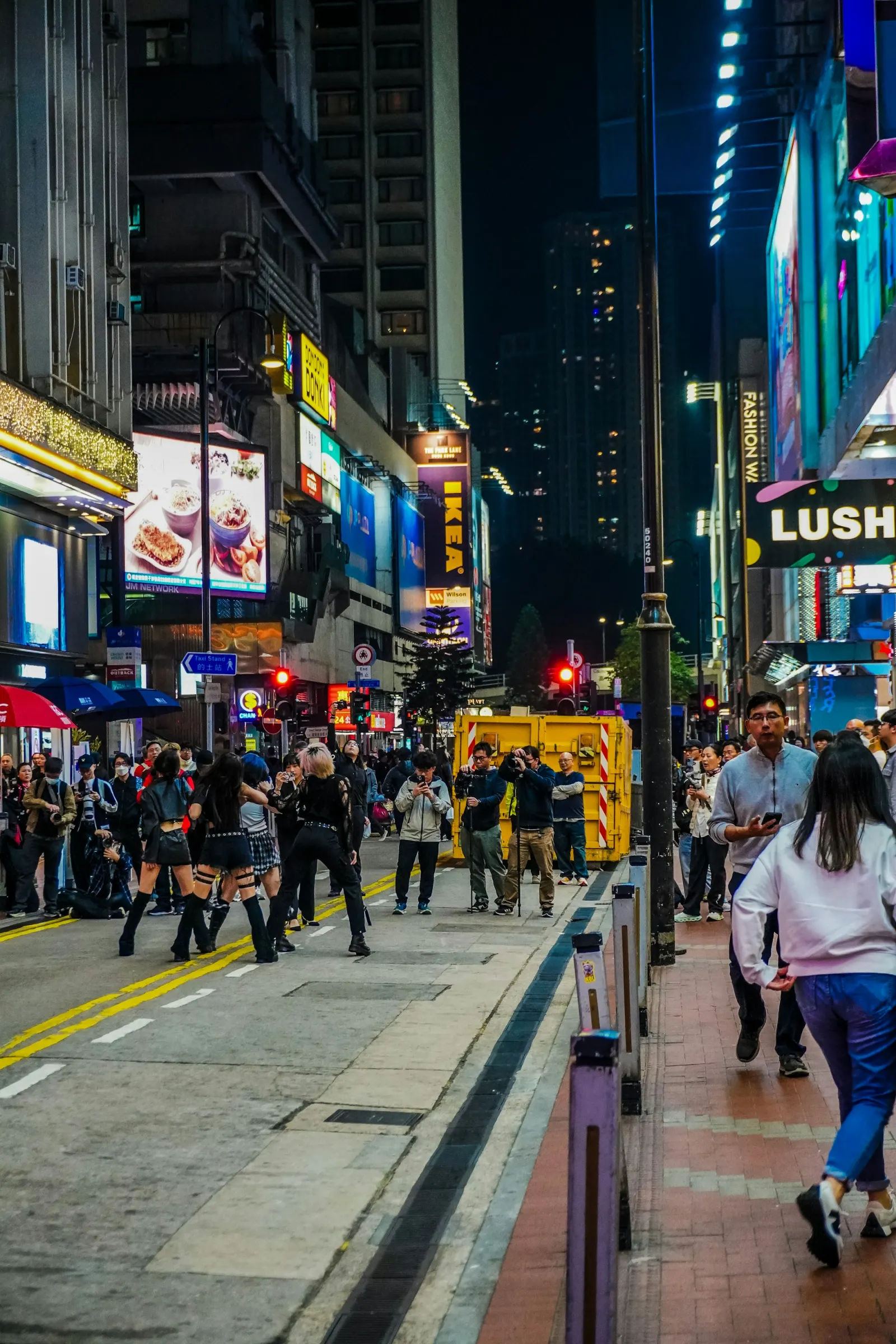
PUBLIC CULTURE
A live performance in Wan Chai shows young audiences, informal gathering and commercial streets sharing space. It is one event, not proof that every district behaves the same way.
CHOOSE AN ENTRY POINT
Menus, speed and hybrid dishes show how the city adapted outside influences.
Read →MOVE · PUBLISHEDRead tram, MTR, ferry, bus, footbridges and escalators as a layered urban rhythm.
Read →GO · PUBLISHEDKeep currency, payment and transport assumptions distinct, with a visible airport fallback.
Read →PUBLISHED FOR HONG KONG
Rail, buses, trams, ferries, footbridges and escalators solve different parts of Hong Kong's dense and steep urban geography.
Six visual readings show how movement, work, water, heritage and public life make Beijing, Shanghai, Guangzhou, Shenyang, Wuhan and Hong Kong different.
Riverbanks, parks, reused industrial sites and commercial streets show how music, performance and social life enter public space across six different cities.
Milk tea, toast, noodles and close-set booths explain how Hong Kong turned outside influences into a fast, affordable and distinctly local institution.
Rivers, ring roads, slopes and rail interchanges explain why a short-looking urban trip can feel easy in one Chinese city and difficult in another.
Beijing, Shanghai, Guangzhou, Shenyang, Wuhan and Hong Kong organise central life differently. A sourced comparison replaces the generic skyline idea.
Build a transport plan that survives a rejected foreign card, dead phone, missed last train or wrong pickup zone across six China gateway cities.
A checked arrival method for Beijing, Shanghai, Guangzhou, Shenyang, Wuhan and Hong Kong, with exact transfer logic and visible late-night fallbacks.
HOW THIS CITY PORTRAIT IS BUILT
The sources at right establish local geography, institutions and current systems. Photographs then have a separate job: show the specific place, action or relationship described in each chapter.
Sources and images are checked separately. A beautiful photograph is not treated as factual proof on its own.