
A skyline can prove that a city has tall buildings. It cannot show what makes the city work.
These six photographs were chosen as one editorial sample, not as a special city group. The public City Network also includes Chengdu, Chongqing, Shenzhen and Hangzhou on equal terms, and expands only when a city can support a real visual and factual portrait.
Each image makes a different claim—city scale, movement, river structure, heritage in current use, public landscape or dense urban form—and each claim can be checked against the city around it.
Beijing: two scales occupy one night
The Beijing frame places a narrow, low-rise lane beneath the curved mass of Galaxy SOHO. The useful subject is not “old meets new” as a slogan. It is the abrupt change in scale: small doors, plants, utility lines and walking bodies remain legible below a privately managed commercial complex designed for a different kind of movement.
Beijing’s official city material describes a capital with extensive historic fabric, research and technology activity, cultural institutions and a very large metropolitan footprint. One photograph cannot carry all of that. It can, however, stop the reader from choosing between two false versions of the city: a museum of imperial monuments or an anonymous field of glass towers.
Shanghai: movement is stacked, not merely fast
In Shanghai, an expressway, a train, scooters, shared bicycles and pedestrians occupy different heights in one night scene. The image explains more than a clean metro portrait because it shows the transfer problem. Every system works at its own speed, but a person still has to move between pavement, station entrance, platform and final destination.
The frame also refuses the usual Pudong-versus-Bund composition. Shanghai’s municipal overview treats the city as a port, economic centre and enormous transport network. The everyday consequence is visible here: infrastructure is not background architecture. It determines how a block sounds, where people wait and which side of a road feels near.
Guangzhou: the Pearl River is a working centre line
Guangzhou’s night panorama holds office towers, housing, the Liede Bridge and reflected light on the Pearl River in one continuous field. The bridge matters because it turns the river from a scenic separator into part of the city’s circulation. The residential blocks matter because Zhujiang New Town is not a freestanding display of corporate architecture.
Guangzhou’s own city history connects its growth to trade, water and repeated shifts in the urban centre. That long relationship should not be reduced to a skyline, but the river view makes one present-day result visible: the newer centre is organised across water, roads, public edges and neighborhoods rather than around a single tower.
Shenyang: heritage and industry are both present tense
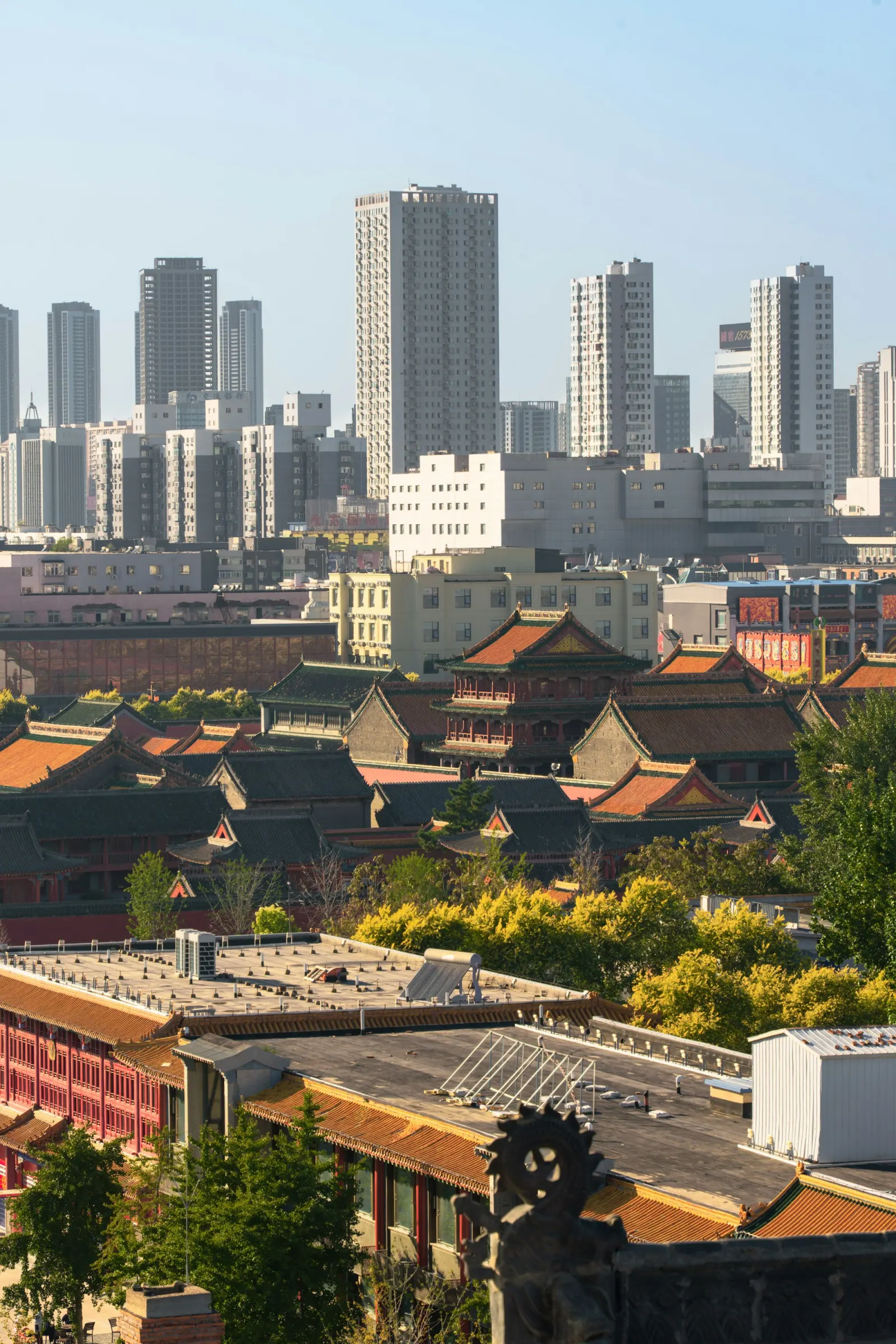
Shenyang’s palace roofs occupy the foreground while apartment and office towers rise behind them. Unlike a split-screen “then and now,” the photograph shows both eras in one urban view. The Imperial Palace is not outside the contemporary city, and the contemporary city did not begin when the towers appeared.
The Liaoning city profile places Shenyang within Northeast China’s industrial and transport networks. Elsewhere in the guide, a modern automotive plant and an industrial museum separate manufacturing memory from current production. The palace view performs a similar correction: heritage is one active layer of a regional metropolis, not the whole identity.
Wuhan: infrastructure becomes public landscape
At Wuhan’s Yangtze edge, a cable-stayed bridge controls the top of the frame while two people fish from the bank. The distance between those scales is the point. A bridge belongs to national and metropolitan circulation; the riverbank can still function as a local place to wait, walk, meet or fish.
Wuhan is structured by the Yangtze and Han rivers and by the historical relationship among Hankou, Wuchang and Hanyang. A sunset photograph can easily become decoration. Here the people, boats, skyline and bridge keep it analytical: water is simultaneously geography, infrastructure and public room.
Hong Kong: a street can become a stage
The Hong Kong photograph is neither a harbor panorama nor a nostalgia image of neon signs. A young crowd and performers occupy a Wan Chai street between retail facades, signs and high-rise housing. The performance is temporary, but the density that makes an audience gather quickly is structural.
Hong Kong’s transport data describes rail, buses, trams, ferries and other networks carrying daily movement through a compact and steep city. This street adds another layer. Dense public life is not produced by transport alone; it emerges when walking routes, shopfronts, late hours, mixed languages and cultural scenes meet in the same small area.
What these images do not prove
The photographs are recent or newly sourced, but they are not population samples. Night scenes overrepresent light; central districts overrepresent investment; a photographer’s position excludes the housing, work and ordinary trips outside the frame. We publish the location, photographer, source and license beside every image so the visual claim remains inspectable.
The next step is not to pick a favorite city. It is to ask a better question of each image:
| Instead of asking | Ask |
|---|---|
| Which skyline looks most advanced? | Which systems and daily activities are visible together? |
| Where is the “real” old city? | How does inherited fabric remain in present use? |
| Which city is most typical of China? | What relationship makes this city unlike the other five? |
| Is the photograph beautiful? | What can the photograph explain, and what is outside its frame? |
Sources and scope
- Beijing Municipal Government: Beijing information — official starting point for the capital’s geography, history and present-day systems.
- Shanghai Municipal Government: Overview — official overview of the city’s economy, port and transport role.
- Guangzhou Municipal Government: Guangzhou past and present — official city history and geographic context.
- Liaoning Provincial Government: Shenyang city profile — official regional, industrial and transport context.
- Wuhan Municipal Government: Overview of Wuhan — official basis for the rivers and three-town structure.
- Hong Kong Transport Department: Annual Transport Digest 2025 — current public-transport context for the compact-city reading.
Image captions provide photographer, source page and reuse terms. This page is an editorial visual reading, not evidence that one scene represents every district or resident.
One useful next step
Open one city guide and follow the same city across a place, an everyday system, culture and a practical journey. A city becomes credible when those routes agree without repeating one another.

.jpg)


.jpg)