
Hong Kong transport is often praised as one seamless system. The praise hides the more interesting reality: several modes solve different physical problems, and the useful journey comes from changing between them.
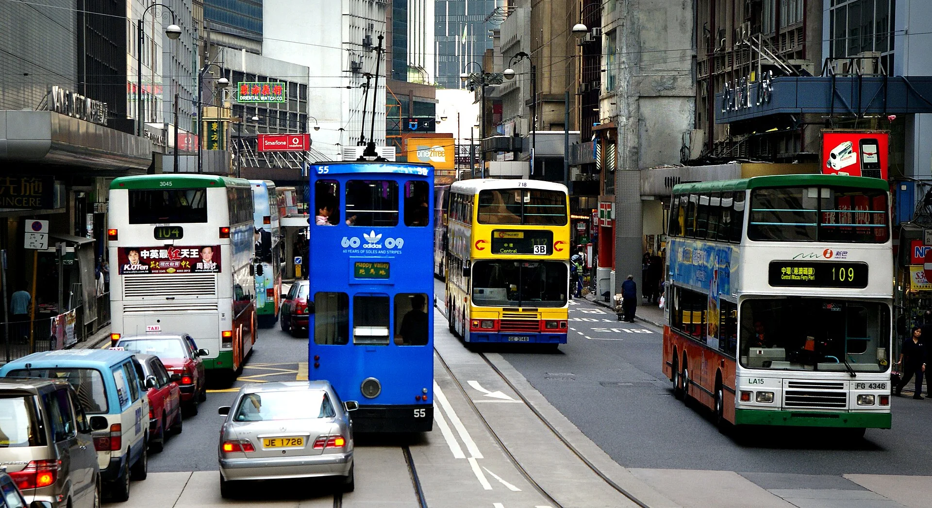
A rail line moves large numbers across the territory. A double-decker bus keeps the street visible while climbing or crossing districts. A tram serves a narrow corridor on Hong Kong Island. Ferries cross water that is also the city’s central open space. Footbridges, lifts and escalators complete trips that would otherwise end at a steep road or a multilane junction.
The city moves in layers because its geography and building density demand layers.
The headline number belongs to a mixed system
Hong Kong’s Transport Department reports about 11.7 million public-transport passenger journeys per day in 2024. MTR services were the largest mode at about 5.18 million daily journeys, while franchised buses carried about 3.78 million. Ferries represented a much smaller share, around 106,700 daily passenger trips.
These are passenger journeys, not unique people. A commuter who uses a minibus and rail on one trip can appear in more than one modal count. The numbers show operating scale; they do not prove that every neighborhood has equal access or that one mode can replace the others.
The MTR Corporation’s annual report supplies the operator view: railway service, station property, maintenance, new projects and commercial operations are managed as connected parts of the business. Because this is company reporting, performance claims should remain attributed to MTR rather than treated as independent evaluation.
Street modes reveal the city that rail skips
Rail compresses distance and removes much of the street from view. Buses and trams do the opposite. They expose gradients, building frontage, traffic and the point where a district changes character.
On Hong Kong Island, the tram’s fixed corridor makes a long east–west section readable. Double-decker buses leave that corridor and climb, tunnel or cross the harbour. Minibuses often connect areas where demand, street width or route pattern does not fit a larger vehicle in the same way.
The lesson is not to choose the most picturesque mode. Choose the mode whose stopping pattern and final approach fit the task. A fast rail trip can still end with a steep walk. A slower bus may deliver the passenger closer to the right elevation.
Vertical links are part of transport
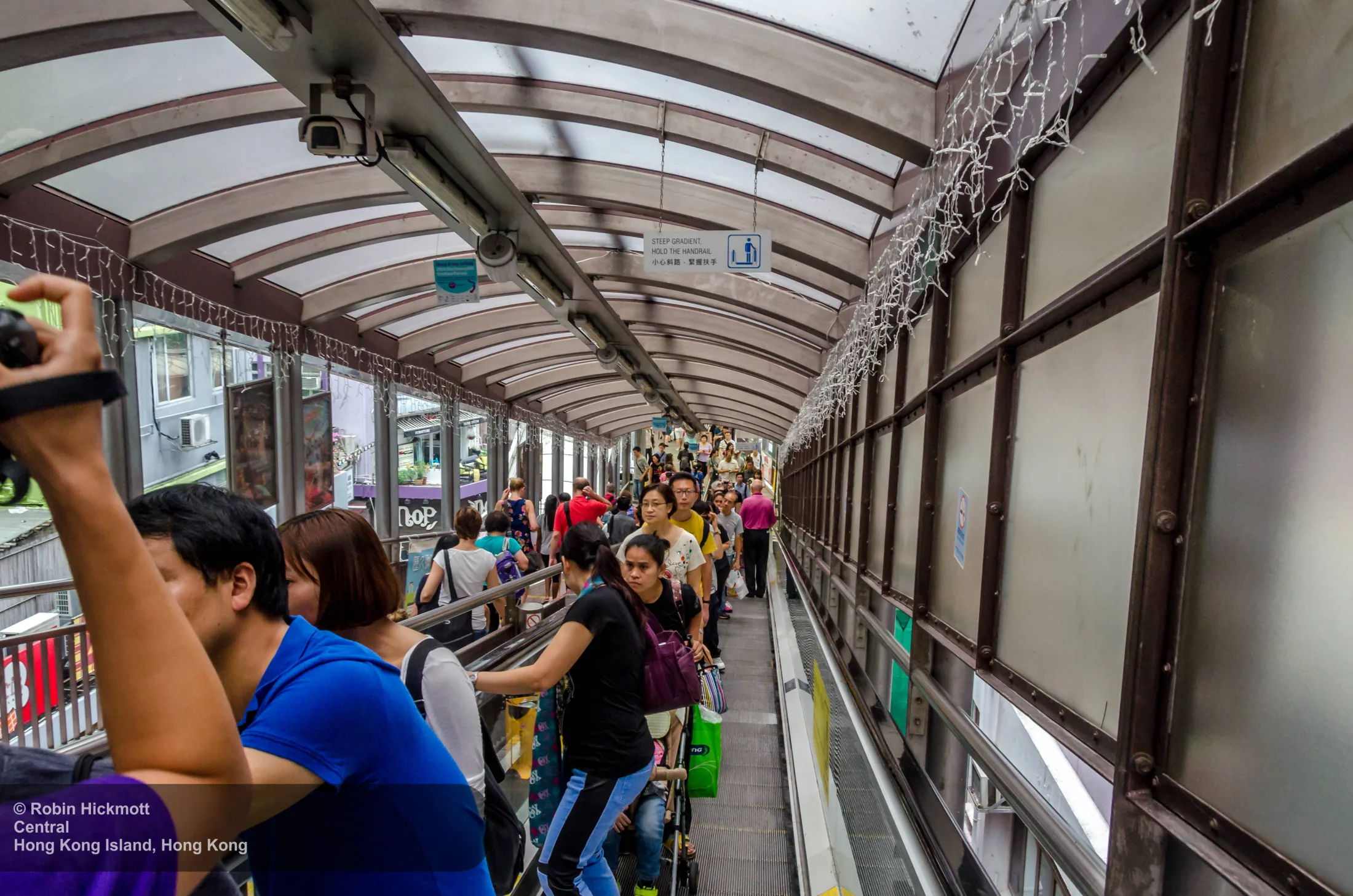
The Central–Mid-Levels escalator is useful because it makes an easily ignored category visible. It is not a vehicle, yet it changes the effort and direction of pedestrian movement through a steep district. Covered walkways, mall passages, station lifts and footbridges do similar work at smaller scales.
Read a vertical connection as a piece of urban infrastructure:
- Where does it begin and end relative to the address you need?
- Does it run in both directions, or does direction change by time?
- Is there a step-free alternative when lifts or escalators fail?
- Does the route remain public, or pass through a building with opening hours?
- Which street level does an exit number actually reach?
This is why a map pin can be close while the walk remains difficult. Horizontal distance and vertical effort are different quantities.
The harbour is not empty space between networks
Ferries carry a small fraction of total public-transport journeys, but modal share does not measure every kind of value. A ferry crossing makes the harbour’s width, shorelines and skyline relationship legible in a way a tunnel cannot. It can also be the direct route between particular waterfront destinations.
Treating the ferry only as nostalgia misses its transport role. Treating it only as transport misses the geographic understanding it provides. Both can be true without claiming that ferries are the main commuting mode.
A practical way to plan one trip
Plan from the final 500 metres backward.
- Identify the entrance and its elevation, not only the building name.
- Check which station exit, bus stop or ferry pier reaches that side of the street.
- Notice whether the final link uses stairs, footbridge, lift or escalator.
- Keep one surface alternative for a lift closure, service disruption or heavy luggage.
- Confirm live fares, hours and accessibility with the relevant operator.
This method is more reliable than assuming rail is always fastest or that a short walk is easy.
Scope matters here
Hong Kong has its own currency, fare products, transport operators and border arrangements. Mainland payment, identity and rail guidance should not be copied onto a Hong Kong journey without checking the local system. The physical connection to the mainland does not erase that practical boundary.
Sources and scope
- Hong Kong Transport Department: Annual Transport Digest 2025—Public Transport — 2024 daily passenger journeys by major mode and the department’s modal definitions.
- MTR Corporation: Annual Report 2025 — operator-reported network, service, property and development context.
This is an urban-systems explanation, not live route advice. Fares, service, station access, escalator direction and lift availability can change.
One useful next step
Open the Hong Kong city field guide, then choose one rail, one street and one vertical connection to read together.
.jpg)
.jpg)