
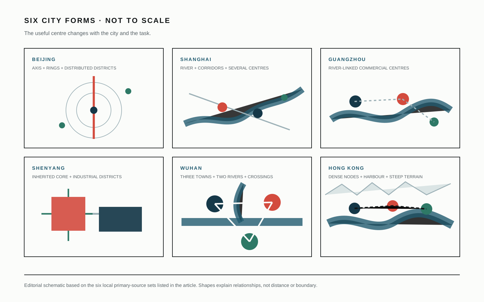
“Where is downtown?” sounds like a practical question. In these six cities, it can produce six different mistakes.
A visitor may expect one square, one skyline or one nightlife district to organise the whole metropolis. That expectation works only when the city has grown around a single dominant centre and still behaves that way. Beijing, Shanghai, Guangzhou, Shenyang, Wuhan and Hong Kong do not share that history or physical structure.
The comparison below does not rank their centres. It identifies the relationship that makes each centre work.
Beijing: a line, several rings and long daily distances
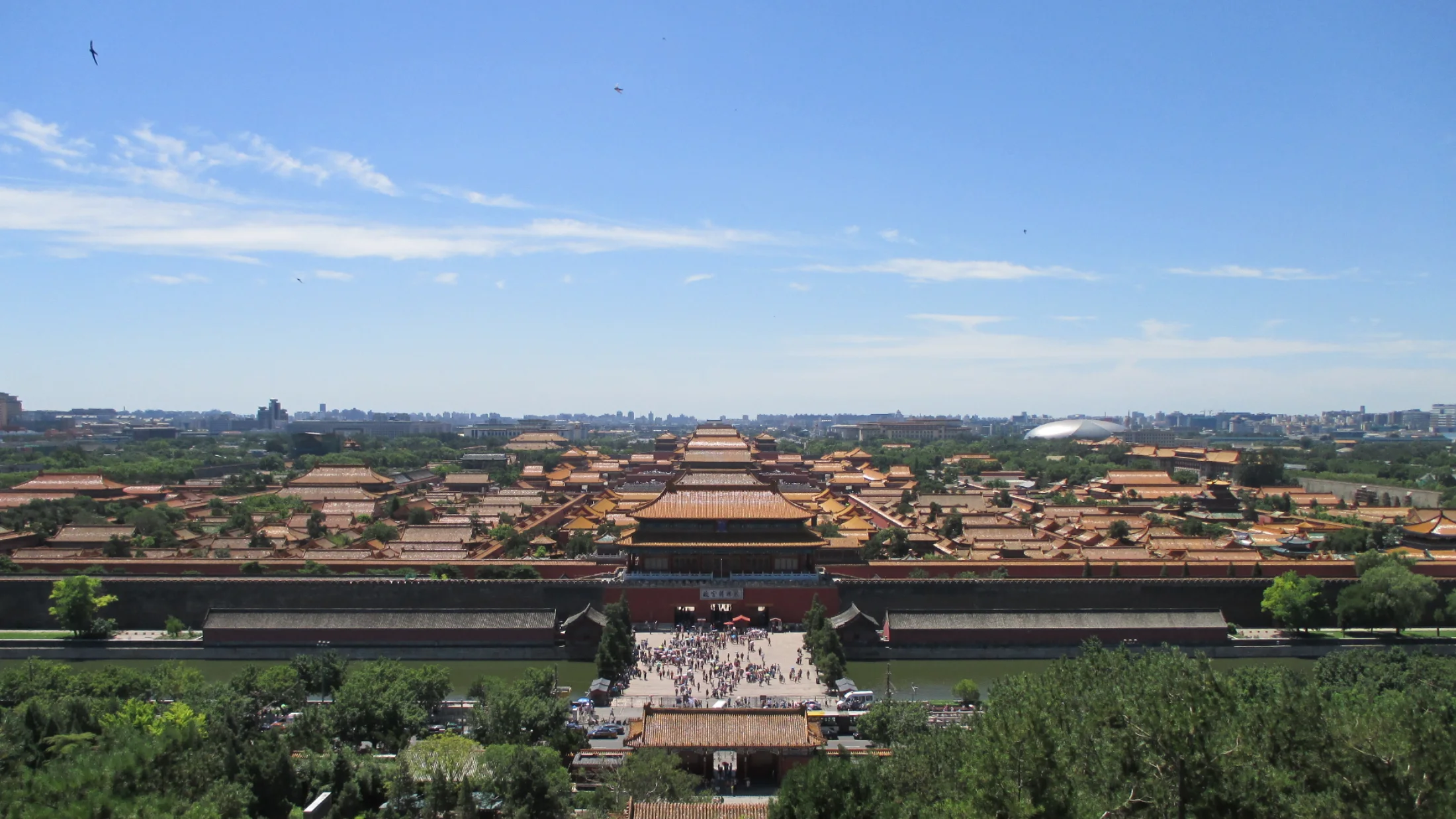
Beijing’s historic Central Axis supplies a powerful north–south line. The modern metropolis extends far beyond it through ring roads, rail lines, large institutional areas, business districts and residential zones.
That means “central” can refer to ceremonial geography, administrative function, employment, cultural life or transport access without identifying the same place. Tiananmen, Guomao and a university district may all feel central for different tasks.
The visual clue is scale. A narrow lane beneath Galaxy SOHO and a multi-mode Guomao crossing both belong to the capital, but they organise movement differently. A Beijing plan needs a destination and a travel-time test; “near downtown” is not enough.
Shanghai: a corridor keeps editing itself
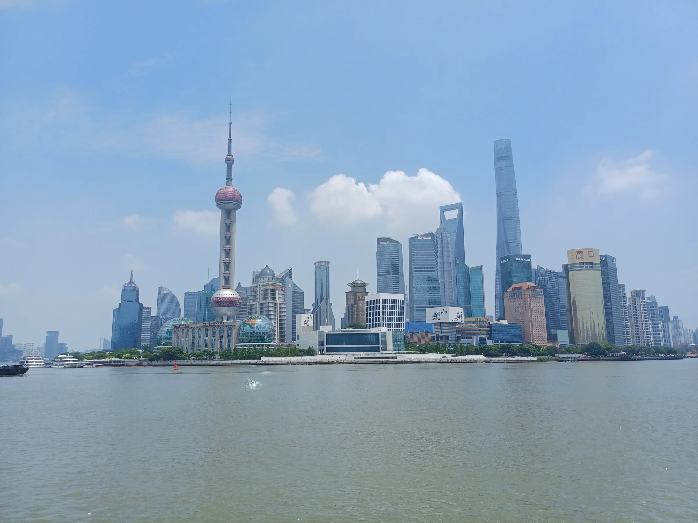
Shanghai’s familiar image faces the Huangpu River, yet the working centre is not one waterfront. The Bund and Pudong hold a global visual relationship across the water. People’s Square, Nanjing Road, lane neighborhoods, major rail hubs and newer districts extend the city’s central functions in other directions.
Along Nanjing Road, older street walls can frame Pudong’s towers. That is a more accurate image than choosing one side as “old” and the other as “new.” Commerce, public space, heritage reuse and transport accumulate along a corridor that keeps being revised.
Shanghai’s centre is therefore best read through movement between adjacent systems: street to metro, lane to commercial frontage, old building to new use, western airport to eastern airport.
Guangzhou: the river connects several centres
Guangzhou’s history is inseparable from trade and the Pearl River, but the present city cannot be reduced to an old commercial core. Zhujiang New Town, older districts, railway hubs, wholesale areas and the wider delta each pull activity in different directions.
The Pearl River panorama makes the newer centre look continuous: towers, housing, bridge and river edge form one lit field. On the ground, the relationship is more complex. Water crossings, metro routes and long north–south movement decide which places feel connected.
“Central Guangzhou” is useful only after the purpose is named. A business meeting, yum cha, wholesale market and evening river walk may start from different centres.
Shenyang: the inherited core remains active
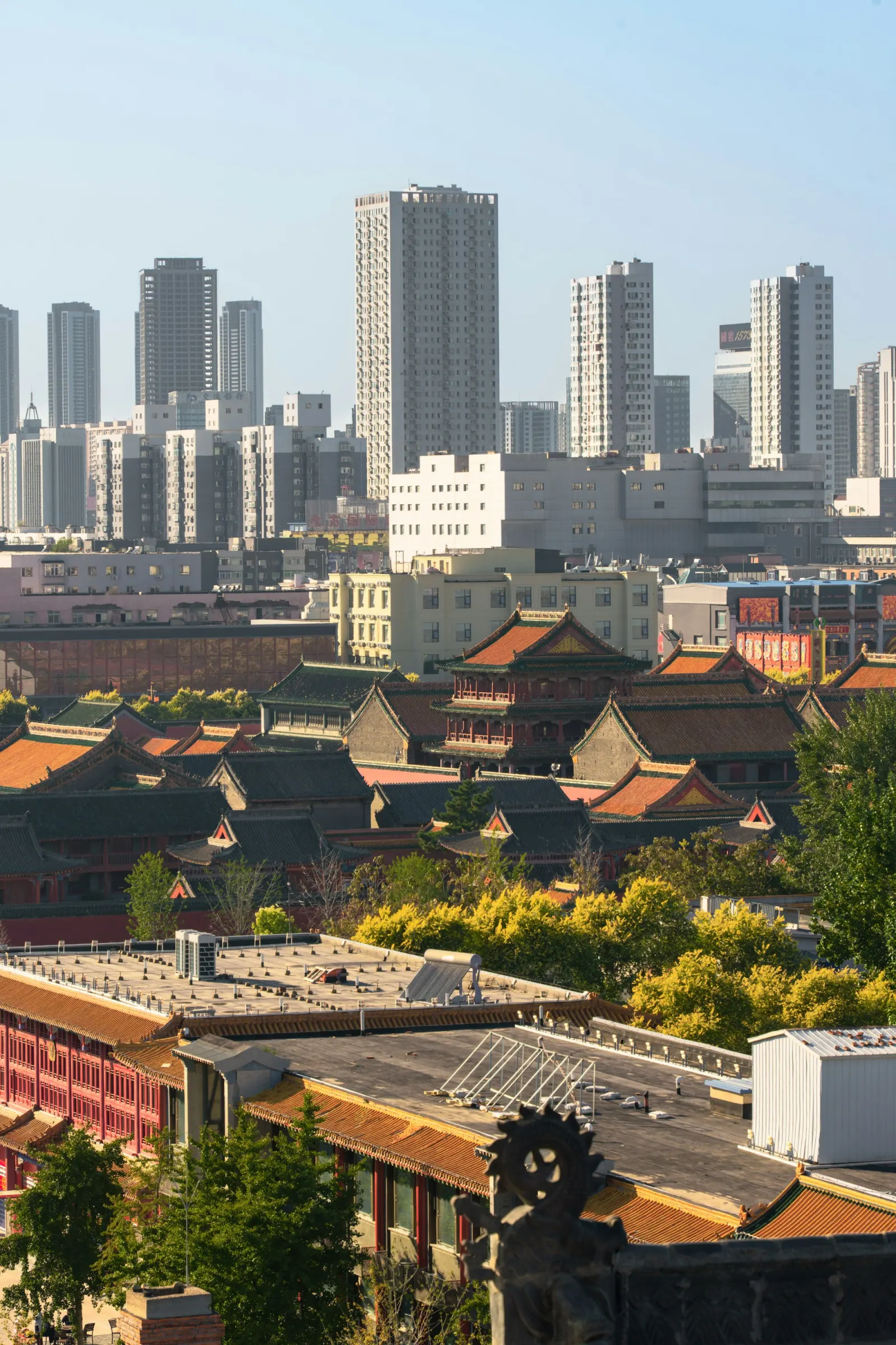
Shenyang’s Imperial Palace and Zhongjie sit close enough to create a compact historical and commercial reading. Contemporary offices, housing, rail stations and industrial districts extend the city beyond it.
The palace-and-skyline photograph is valuable because it refuses a clean historical break. The old centre is not abandoned scenery, while present manufacturing is not confined to a distant future zone. Heritage, consumer life and industrial work remain parts of one regional metropolis.
For orientation, Zhongjie can be a strong first centre. For understanding the city, it must be paired with Tiexi, transport hubs or newer residential and business areas.
Wuhan: three towns meet through two rivers
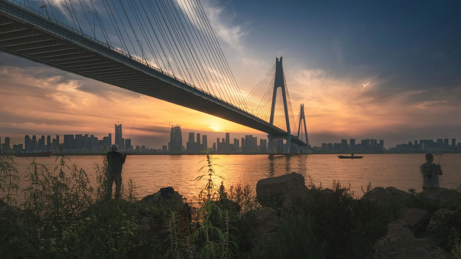
Wuhan supplies the clearest warning against singular downtown language. Hankou, Wuchang and Hanyang developed in relation to the Yangtze and Han rivers before forming the modern municipality.
The rivers do not merely divide the map. Bridges, ferries, rail and riverfront public spaces continually connect and reframe the three-town structure. A skyline across water may look near while requiring a long bridge or rail journey. A destination on the same bank may feel more continuous even at greater map distance.
The centre changes with the task: Hankou commercial history, Wuchang’s institutions and university life, Hanyang’s industrial and cultural sites, or a river edge shared across them.
Hong Kong: a chain of dense centres
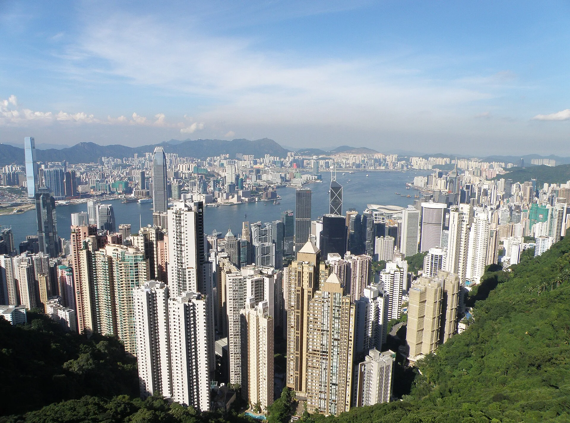
Hong Kong’s compact image can disguise its geography. Mountains, water, reclaimed land and steep slopes constrain movement. Rail, buses, trams, ferries, escalators and footbridges make a series of dense centres work together.
Central is both a named district and only one part of the urban chain. Kowloon, new-town centres and other island districts organise daily life at different scales. The same transport network can make two places feel close while a steep pedestrian connection adds effort at the final few hundred metres.
Here, downtown is not a circle around one point. It is a sequence of accessible nodes connected through high-capacity movement and dense street life.
A comparison that changes how you plan
| City | Do not assume | Start with |
|---|---|---|
| Beijing | The historic core is close to every modern destination | District, ring-road position and journey time |
| Shanghai | The waterfront is the whole centre | Corridor, river side and transfer sequence |
| Guangzhou | One CBD explains a trade metropolis | River crossings and the purpose of the trip |
| Shenyang | Heritage or industry must define the whole city | Historic-commercial core plus one present-day work district |
| Wuhan | A single downtown sits on one bank | Which town, which river crossing and which station |
| Hong Kong | Compact geography means easy final access | Rail node, slope, footbridge and final walking route |
These are editorial planning heuristics derived from official city geography and transport material. They are not administrative boundary definitions.
Sources and scope
- Beijing Municipal Government: city information
- Shanghai Municipal Government: city overview
- Guangzhou Municipal Government: city profile
- Liaoning Provincial Government: Shenyang profile
- Wuhan Municipal Government: city overview
- Hong Kong Transport Department: Annual Transport Digest 2025
The official sources establish geography, city functions and transport structure. The comparison is an editorial synthesis and does not claim that every resident uses the city in the same way.
One useful next step
Open the six-city street-level field note. It shows the visual evidence behind these different kinds of centre.

.jpg)
.jpg)