Wuhan becomes clearer when the water is treated as structure rather than scenery. The Yangtze and Han rivers divide the metropolis into Hankou, Wuchang and Hanyang. Bridges, tunnels, ferries and rail lines bind them together, but the names still carry different histories and expectations.
Calling them the “three towns” does not mean modern Wuhan is three separate municipalities. It is a way to understand why crossing the river can change the street pattern, institutional landscape and story a resident tells about the city.
The confluence produced different banks
Wuhan’s official overview identifies the Yangtze and Han as the basic geographic division. Hankou developed as a commercial and financial centre. Wuchang became strongly associated with government, education and the 1911 Revolution. Hanyang carries an important industrial history.
Those descriptions are broad, not exclusive. Each side contains housing, schools, shops and workplaces. Their value is that they give a first-time reader a more useful mental map than “downtown versus suburbs.”
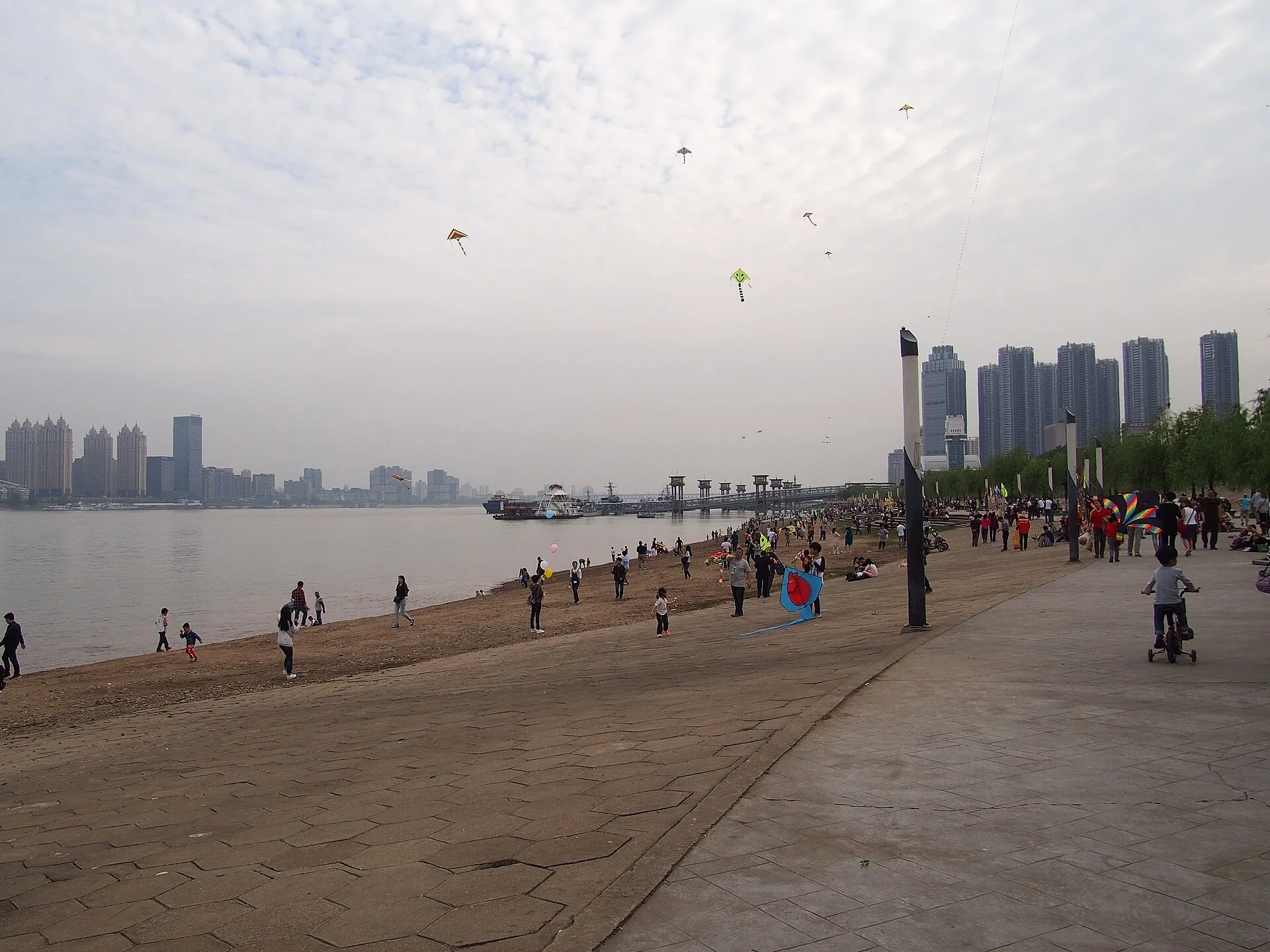
On the Hankou riverfront, the Yangtze reads as a wide piece of civic space. The embankment, promenade and buildings behind it show both flood-management infrastructure and public life. Across the water, Wuchang’s landmarks and institutions occupy another urban field. Up the Han River, Hanyang enters the picture through a narrower water relationship and a different industrial story.
Bridges changed distance without deleting identity
Before treating a bridge as a landmark, ask what it connects. A crossing can join rail routes, shorten a commute and redistribute development. It can also preserve the feeling that the two ends are different places.
The Wuhan Yangtze River Bridge opened in 1957 and carried both road and rail. It belonged to a national infrastructure programme as well as the local problem of linking the three-town city. Later crossings multiplied the options, but the original bridge remains useful because its double role is visible: city streets and long-distance rail occupy one structure.
Modern metro lines and road tunnels make cross-river movement routine. That routine should not be confused with frictionless movement. Station access, interchange length, bridge congestion and the enormous width of the metropolitan area still determine how close two addresses feel.
Read one day across three scales
A productive Wuhan route uses three scales instead of racing between attractions:
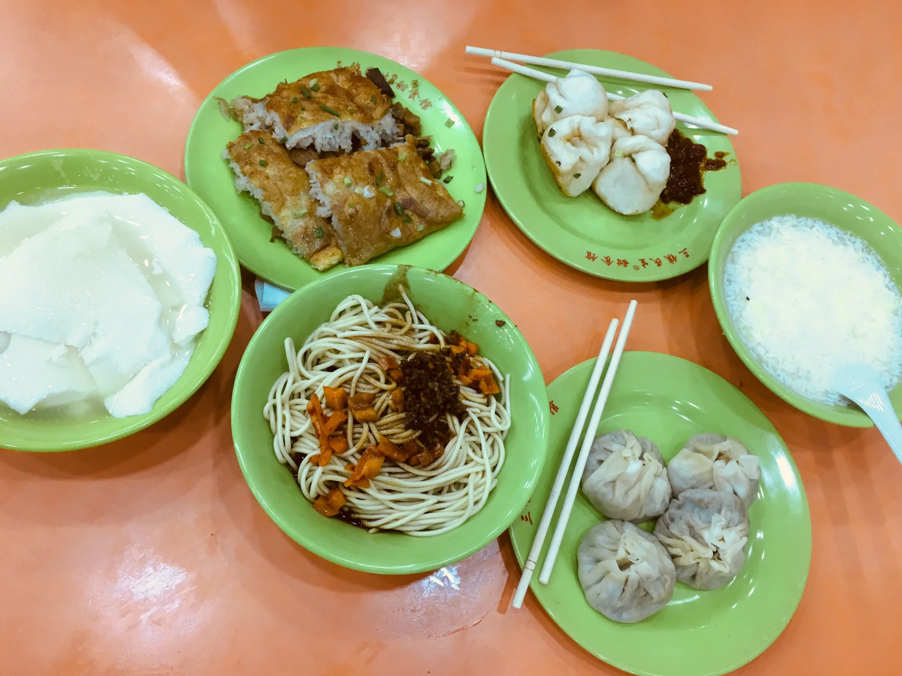
- Table: begin with breakfast and watch how quickly a public meal is assembled, eaten and carried away.
- Street: walk a Hankou block or Wuchang institutional area and notice frontage, shade, traffic and ground-floor use.
- River: reach a ferry, bridge or embankment and identify which town lies on each side.
Breakfast belongs in this spatial reading because guozao is not merely a list of foods. Queues, portable bowls, small shops and morning movement show how the city uses the street before the workday settles. The meal makes daily pace visible at human scale; the river explains why that pace is distributed across several centres.
The riverfront is infrastructure and public room
UNESCO’s monitoring material for Wuhan’s City of Design work places the Yangtze left bank inside projects that combine historic landscape, old-neighbourhood renewal, commerce and public use. That combination deserves scrutiny. A renovated waterfront can improve access and make industrial or historic fabric legible. It can also replace ordinary uses or smooth away evidence of how the district worked.
When viewing a riverfront, separate four layers:
| Layer | Question |
|---|---|
| Water management | What protects the city from seasonal river conditions? |
| Movement | Which ferry, bridge, road or rail link crosses or follows the water? |
| Public space | Who can sit, walk, exercise or gather here, and at what times? |
| Historic fabric | Which buildings or street relationships remain, and which were reconstructed? |
This prevents a beautiful promenade from becoming proof of an uncomplicated urban success.
What “three towns” leaves out
Contemporary Wuhan includes large lake systems, development zones, university districts, manufacturing and research clusters, new rail hubs and extensive outer districts. The old three-town idea helps with orientation; it does not explain the full metropolitan economy or every resident’s daily geography.
It is also possible to overstate neat identities. A person may live in Hanyang, study in Wuchang and socialise in Hankou. That crossing pattern is part of modern Wuhan. Historical names remain meaningful precisely because infrastructure lets people move among them.
Sources and scope
- Wuhan Municipal Government: Overview of Wuhan — official geographic basis for the Yangtze, Han River and three-town structure.
- UNESCO: Wuhan City of Design Monitoring Report 2017–2021 — riverfront historic landscape and old-city renewal context.
This is a source-based spatial introduction, not current navigation or flood-safety advice. Live routes and river conditions require local verification.
One useful next step
Continue with Wuhan’s public breakfast culture, then place the meal on your three-town mental map.