
Beijing becomes shallow when it is divided into two postcards: red walls for “ancient China” and glass towers for “modern China.” The real capital is harder and more interesting. Inherited axes still organise movement and sightlines; ritual grounds function as enormous public landscapes; hutong addresses keep changing in use; universities, laboratories and firms form a distributed research belt; and ring roads make all of those places part of one metropolitan day.
This route is not an itinerary. It is a visual sequence for recognising the relationships that make Beijing specific.
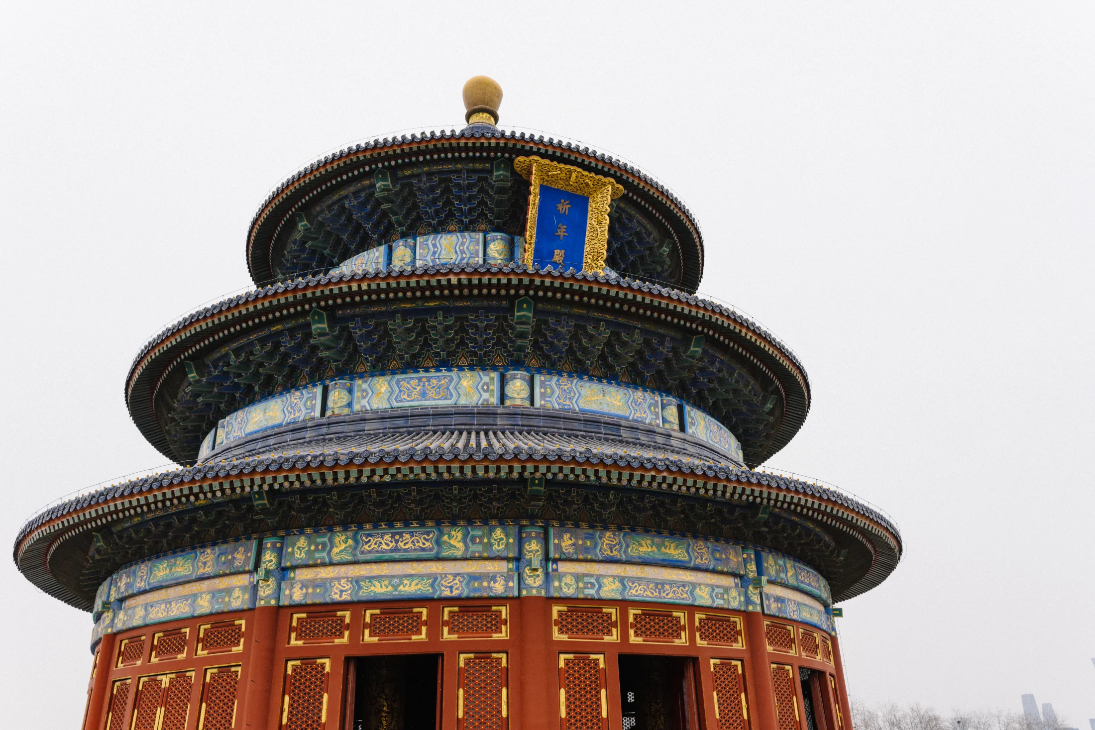
The monument is only the visible node
The Hall of Prayer for Good Harvests is easy to recognise, but it does not explain the Temple of Heaven by itself. The place depends on procession, orientation, raised platforms, changing enclosure and the long distances between structures. UNESCO describes the complex as an imperial sacrificial altar whose layout and symbolic design express a relationship between earth and heaven. On the ground today, those inherited geometries are also experienced as paths, tree cover, exercise space and a large break in the surrounding street fabric.
That double life matters. Calling the site “traditional architecture” is true but incomplete. It is simultaneously a preserved ritual system, a managed landscape and a piece of contemporary public geography.
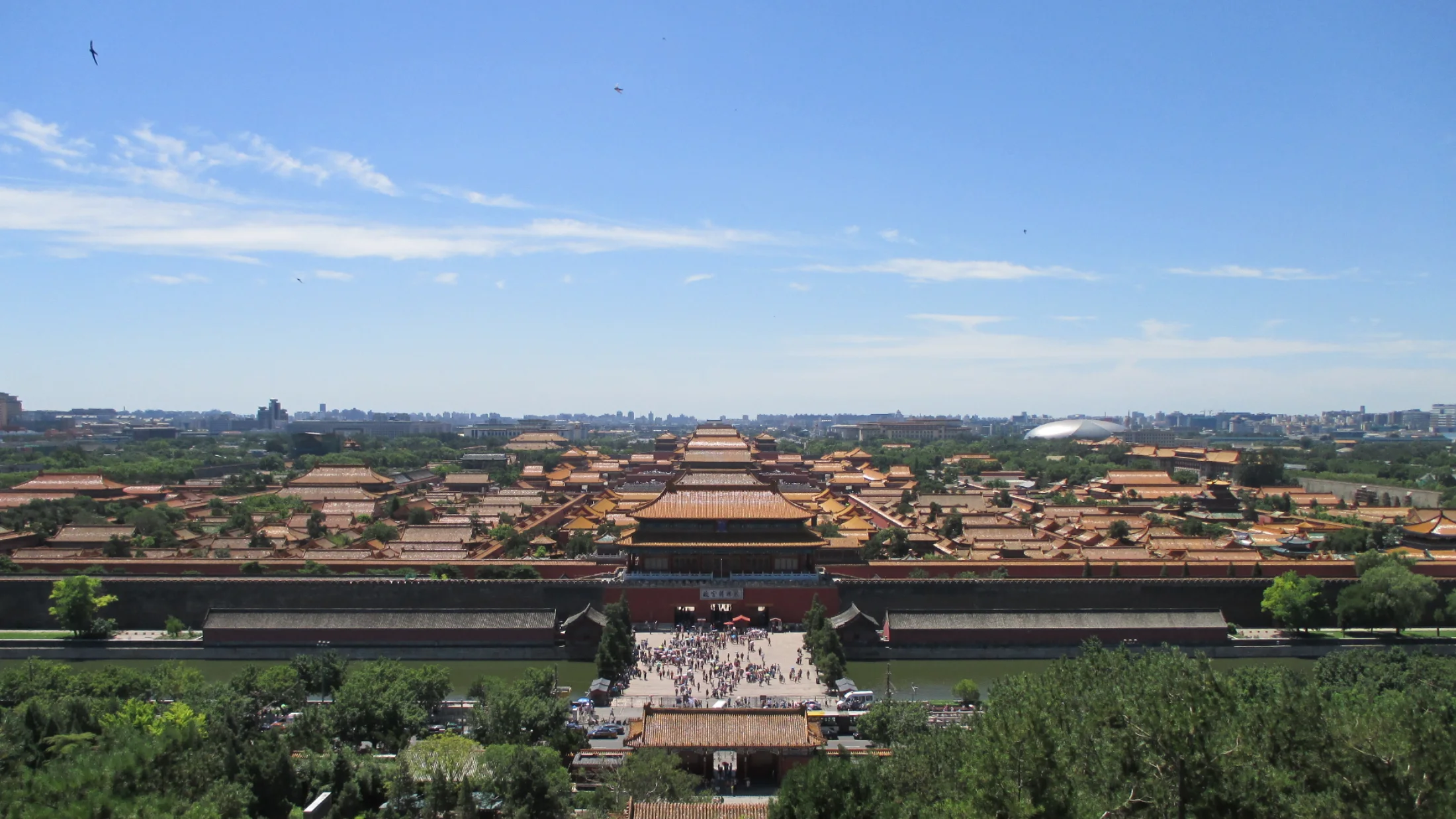
Order continues beyond the palace wall
From above, the Forbidden City is not one decorated building. Gates lead to courtyards, courtyards to halls, and walls to further thresholds. The repeated sequence provides a measure of political and ceremonial order at the centre of the imperial capital. Yet the most important detail in the photograph may be the horizon: contemporary Beijing does not disappear while the palace is being viewed.
The Beijing Central Axis extends that logic beyond the palace. Its components were produced and altered over centuries, and its present management includes heritage conservation, reconstructed sections and spaces used every day. Reading the axis as a working urban line avoids two mistakes: treating the centre as an untouched relic, or treating current Beijing as if it began after the relics ended.
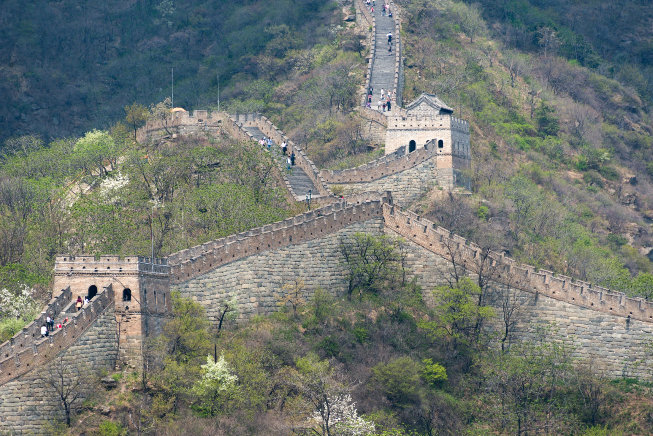
The capital’s defensive landscape is mountainous
Central Beijing is famously flat and ordered, but its larger geography reaches mountain systems to the north. At Mutianyu, the Great Wall rises and falls with ridgelines. The steep stairs, repeated towers and shifting sightlines reveal it as a route built through terrain, not a freestanding decorative object.
UNESCO’s Great Wall record covers a vast, multi-period system far beyond one Beijing section. That scope is important: a photograph from Mutianyu can explain how wall and mountain interact, but it cannot stand for every construction period or condition across the complete heritage property. Visitors in the frame are useful evidence here. They make the gradient and distance legible while reminding us that this is a managed, heavily visited section in the present.
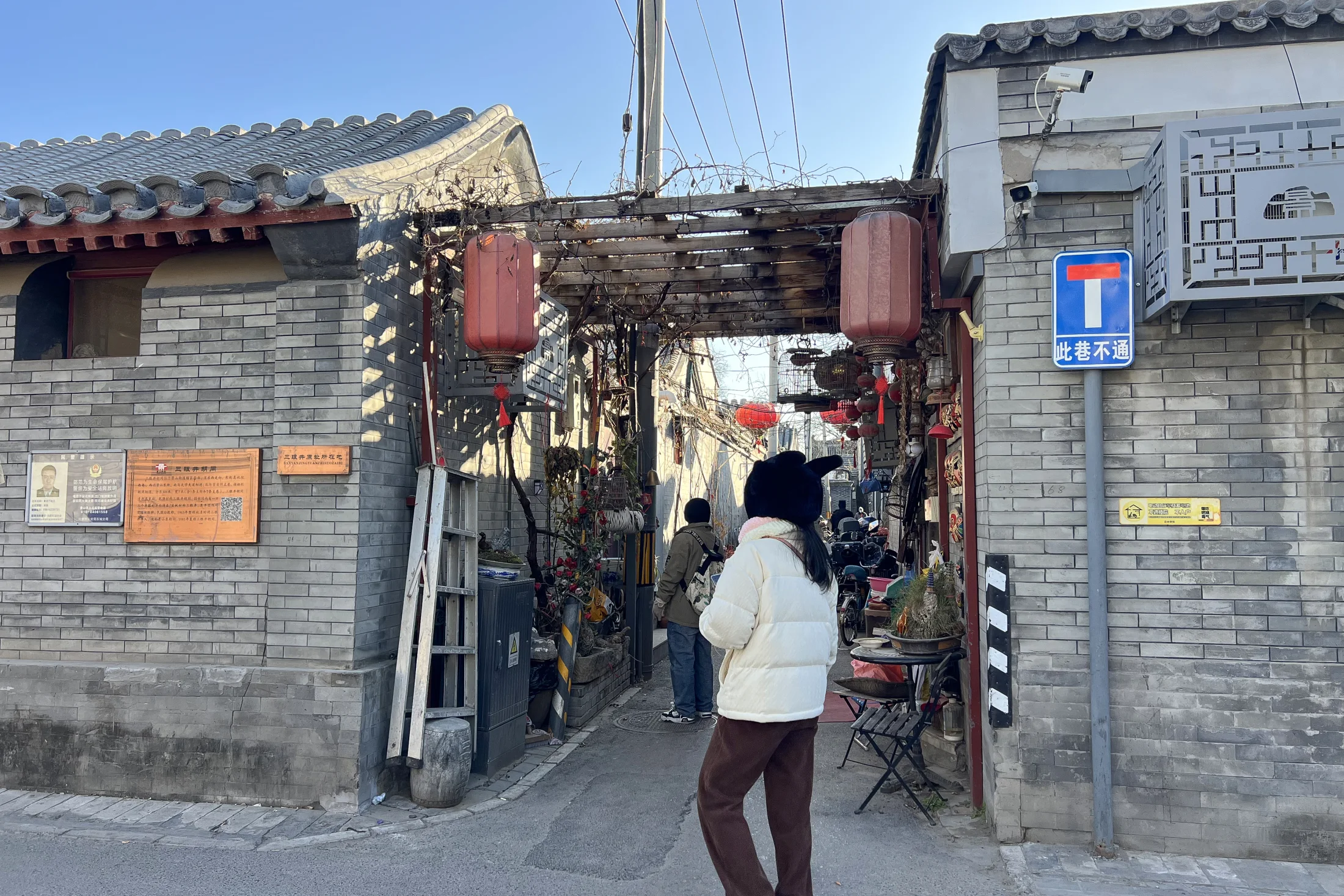
A hutong is a circulation space and an address
The lane above is visually quieter than the palace, but it contains denser evidence of adaptation. Entrances open directly onto the route. Vines cross overhead. Signs, stored objects and parked vehicles negotiate limited space. People are entering rather than posing for an empty “old Beijing” picture.
Hutongs vary in building condition, tenure, commercialisation and resident life, so one lane should never be used as a universal claim. What the image can show is a basic urban fact: heritage is lived through access, maintenance, privacy and ordinary storage. A design review that notices only grey brick misses most of the system.
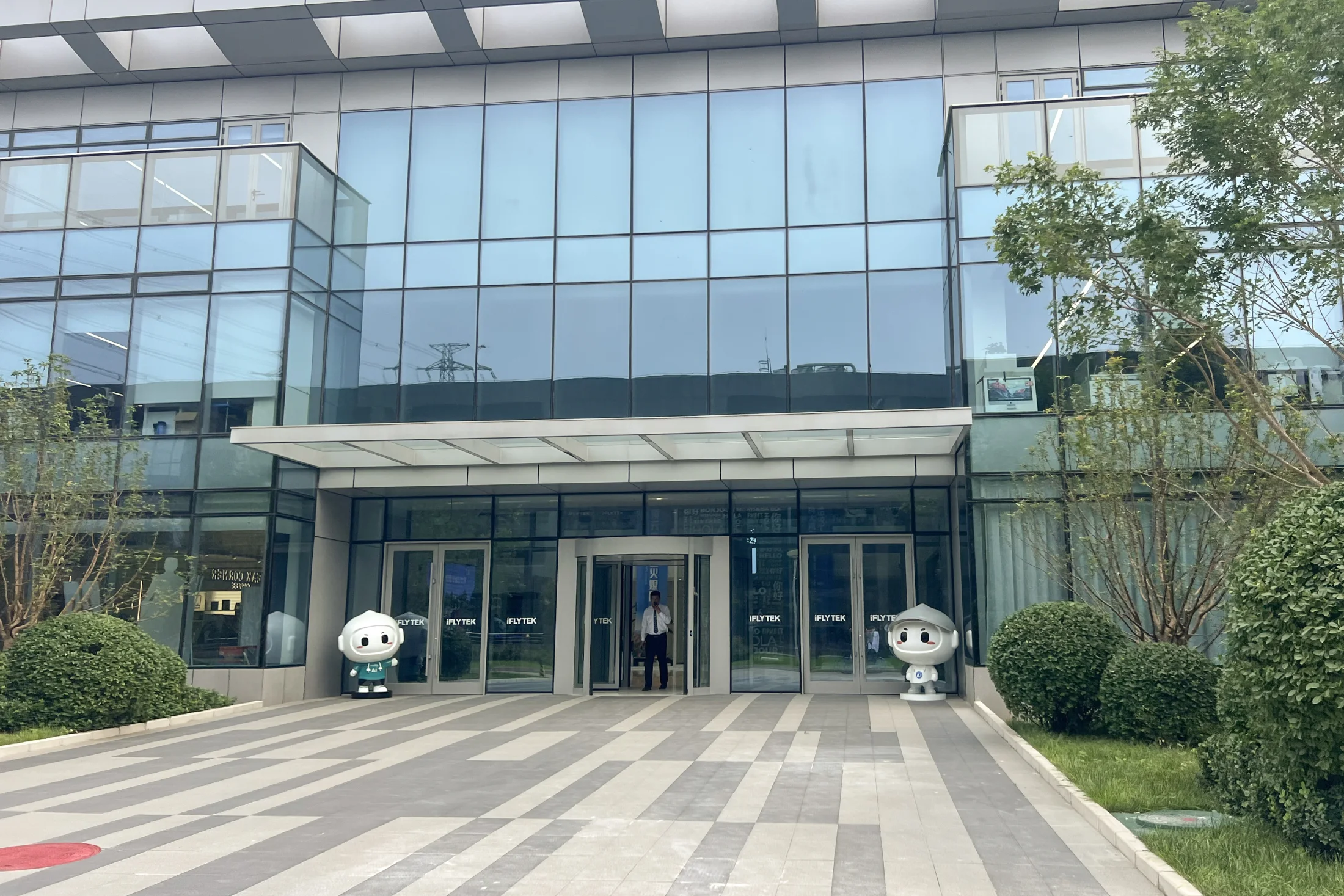
Zhongguancun is not one electronics street
International shorthand often compresses Zhongguancun into “China’s Silicon Valley” or into the electronics retail streets familiar from earlier reporting. The actual research landscape is distributed across university districts, laboratories, municipal programmes, company campuses and specialised parks. The municipal science and technology commission is one official starting point for that institutional structure.
The photograph deliberately avoids making a glowing device or corporate logo the proof. It shows a current tenant inside a landscaped office park. To understand the system, the reader must connect that physical node to people, institutions, funding, research and the long commute patterns of northwest Beijing. Technology is not an aesthetic layer painted over the “old city”; it is another geography with its own buildings and daily movement.
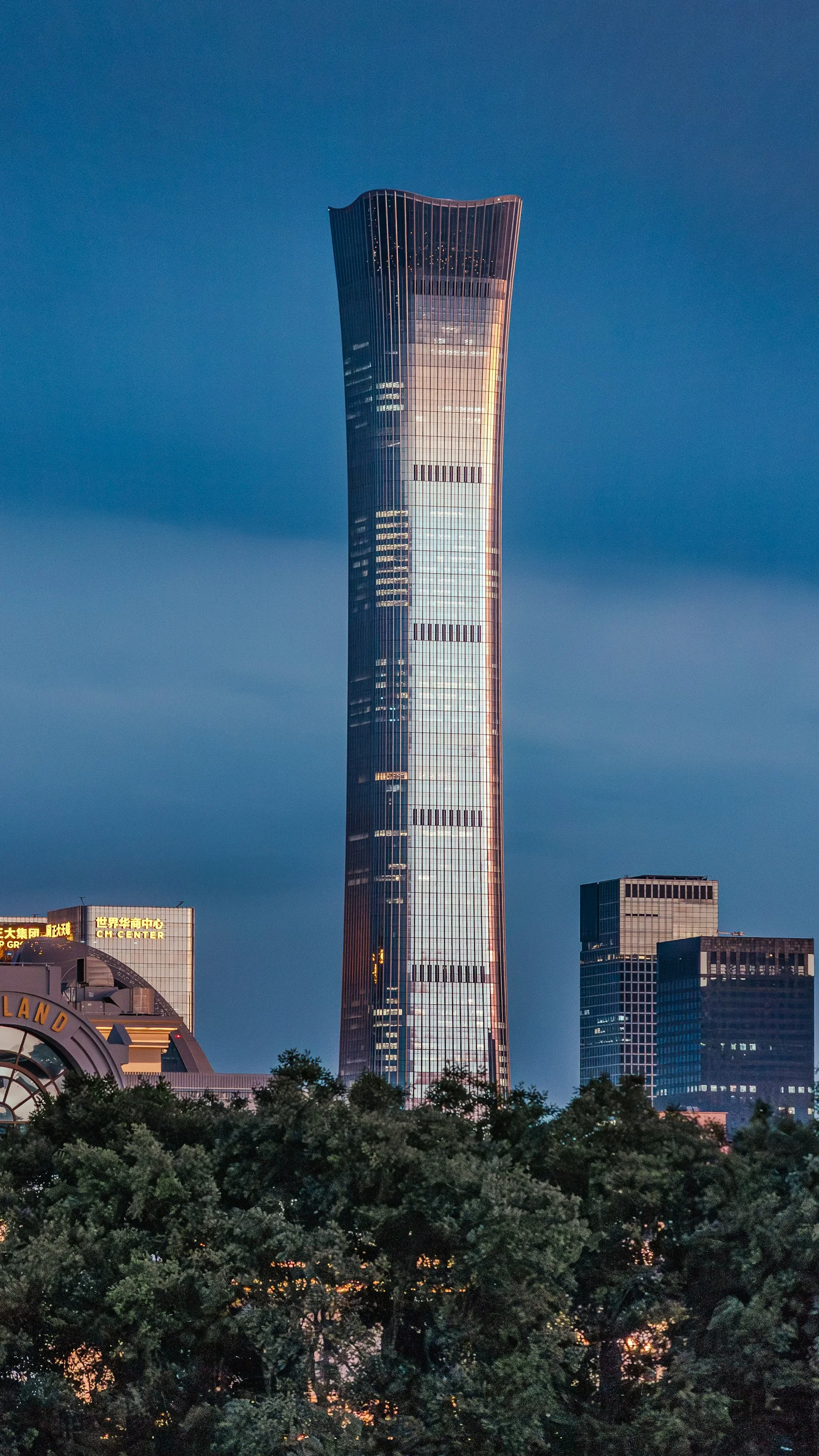
Return every grand idea to an ordinary crossing
Palace order, mountain defence and research policy operate at enormous scales. A resident still has to cross a road, transfer between lines, collect a delivery or find an entrance. Keeping that daily layer in the Beijing portrait prevents architecture from becoming spectacle and technology from becoming promotional imagery.
The useful conclusion is not that Beijing “blends old and new.” Almost every long-lived city does. Beijing’s specificity lies in which systems coexist: a monumental north–south order, mountain edges, granular lane networks, powerful research institutions, airport and rail investments, and the transfer costs of a vast metropolitan area. Each photograph above names one relationship and also states what it cannot prove.
Questions readers ask next
Is Beijing best understood as an old city or a technology city?
Neither label is sufficient. Palace planning, temple landscapes, lived hutongs, research campuses, airports and daily movement operate in the same capital.
Can this visual route be completed comfortably in one day?
It is an editorial sequence, not a one-day itinerary. The places are separated by large distances and different access requirements; use the chapters to choose a coherent route.
Sources and scope
Heritage descriptions are checked against UNESCO records for the Central Axis, Temple of Heaven and Great Wall. Present-day city and science context begins with the Beijing municipal overview and the municipal science commission. The route does not claim to cover every hutong, research park or Great Wall section, and it is not a live visitor guide.