
.jpg)
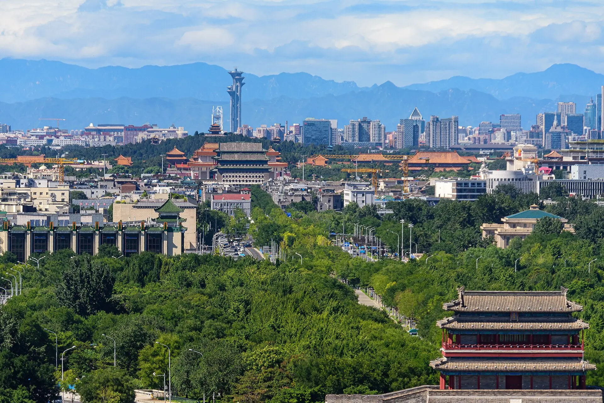
Beijing’s Central Axis is often reduced to a line on a tourist map: start near the Drum and Bell Towers, pass Jingshan and the Forbidden City, continue through Tian’anmen, and finish around the ceremonial complexes to the south. That route finds famous buildings. It misses the stronger idea. The axis is a way of arranging power, ritual, movement and the image of the capital in relation to one another.
UNESCO inscribed the ensemble in 2024 as a group of buildings, monuments, roads and archaeological remains running north to south through historic Beijing. The components were not all built at once. Their value lies partly in the persistence of an ordering principle through the Yuan, Ming and Qing dynasties, then through a modern city whose streets and public functions changed around it.
Read relationships before objects
An axis is not simply a road. Some parts can be walked; other relationships are visual, ceremonial or spatial. Gates create thresholds. Courtyards delay arrival. Symmetrical placement makes one building legible against another. A hill can establish a viewpoint even when it is not on the same continuous pedestrian surface.
This is why a photograph of one roof cannot explain the system. Stand at a point where the north-south direction is visible and ask three questions: what is placed in the centre, what is balanced to either side, and what must be crossed before the next space opens? The answers reveal hierarchy without needing a specialist vocabulary.
UNESCO connects this arrangement to principles recorded in the Kaogongji, or Book of Diverse Crafts: a capital ordered around a centre, symmetry and ritual position. That does not mean Beijing is a literal diagram copied unchanged from an ancient text. The heritage claim is that the planning tradition remained visible through adaptation.
The line contains different kinds of authority
The Forbidden City concentrates imperial residence and government. The Temple of Heaven and other sacrificial sites connect the capital’s plan with ritual calendars. Gates and historic management facilities controlled access. Later civic and public buildings changed the political meaning of central space.
Putting those functions on one axis did not make them identical. It made their relationship readable. The palace was not just a large house, and a gate was not just an opening. Position established rank, sequence and controlled approach.
For a present-day visitor, the useful contrast is between ceremonial order and ordinary use. Former imperial spaces now operate as museums, parks, streets and public gathering places. UNESCO’s assessment explicitly notes that functions changed while the axis continued as a core of the capital. Continuity here means a durable spatial structure, not frozen historical life.
North and south do different work
The northern part can feel tighter and more closely tied to the grain of older neighbourhoods. The central palace sequence uses enclosure and repeated thresholds. Farther south, larger open spaces and ceremonial complexes produce a different rhythm. Moving along the line therefore changes scale as well as location.
Do not try to cover the entire ensemble as a race between pins. Choose one segment and compare two forms of order. Around the Drum and Bell Towers, notice how a monumental pair meets surrounding streets. At Jingshan, use height to understand alignment. Around the palace, count thresholds rather than rooms. South of the monumental civic centre, compare the direction of the axis with the placement of ritual sites.
That method produces a clearer memory than collecting façades. It also keeps the contemporary city visible: traffic, security boundaries, ticketing and conservation rules determine what can actually be crossed.
Heritage status does not remove pressure
The protected property and its buffer zone sit inside a heavily used capital. UNESCO identifies urban development and tourism pressure as management concerns. Conservation therefore involves more than repairing old timber. Building height, sightlines, visitor volumes, road use and the treatment of surrounding neighbourhoods affect whether the axis remains legible.
Reconstruction also complicates easy claims of untouched authenticity. The heritage documentation recognises demolition, rebuilding, remodelling and rehabilitation in parts of the ensemble. The defensible conclusion is not that every surface is ancient. It is that location, layout, major architectural relationships and an inherited planning logic remain unusually coherent.
The useful takeaway
Beijing’s Central Axis is best understood as a sentence written with space. Individual buildings are its nouns, but sequence, symmetry and thresholds supply the grammar. Read only the attractions and the city becomes a cabinet of monuments. Read the relationships and a long argument about what a capital should look like comes into view.
Sources and scope
- UNESCO World Heritage Centre: Beijing Central Axis — inscription, components, planning logic, authenticity and management pressures.
- ICOMOS evaluation of the Beijing Central Axis nomination — development history, boundaries and independent heritage assessment.
This is a source-based guide to spatial interpretation, not a walking itinerary or an accessibility audit. Opening hours, ticket rules and security arrangements can change and should be checked with individual sites.